Our infrastructure team manage more than 5,000km of high-pressure oil pipelines and along this network, there are several water crossings including rivers, streams, canals, and estuaries.
One of our major clients required us to collate information which included photographs, bank stability details, and measurements of the channel. After the initial scoping exercise, a list of water crossings requiring a professional survey was confirmed which resulted in our work with Storm Geomatics.
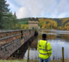
The surveys assessed active erosion or deposition occurring within the site extent that may impact the covering depth or support structure integrity of the pipeline. This included the state of a dynamic physical landscape around an economically and environmentally sensitive asset, to ensure that they are safely buried or suspended and that they were not at risk of damage.
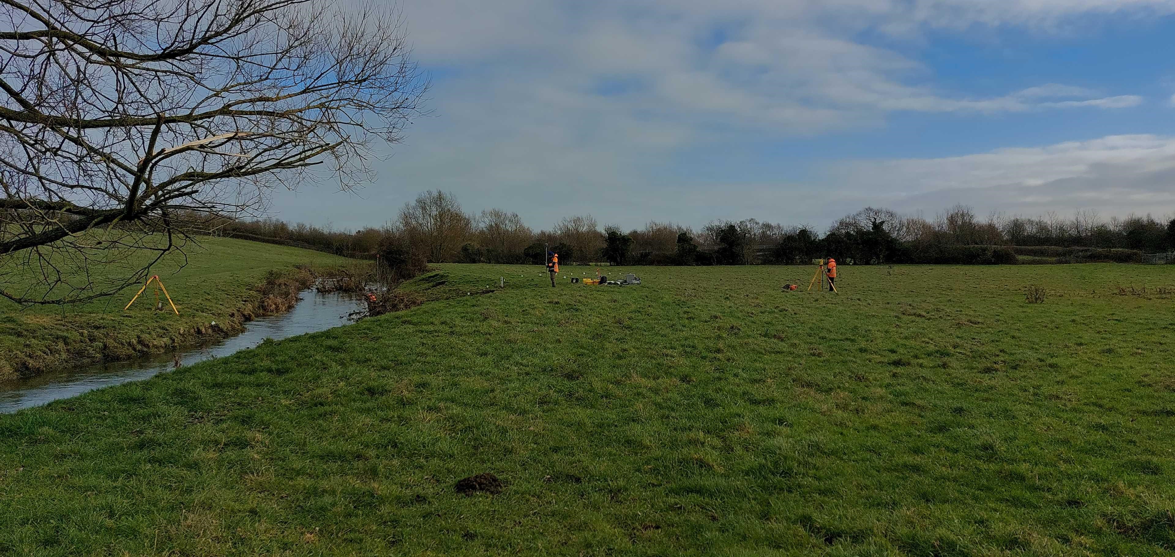
Storm Geomatics conducted these topographic, pipe tracing and bank stability surveys which included 12 sites across 4 separate fuel pipelines, covering the South of England. The surveys had a variety of challenges including fast, varied water levels, steep unstable banks, and dense vegetation. Topographic surveys and pipe tracing were undertaken on the bank tops and the riverbed around the pipeline crossings and this data helped produce cross-sectional information at specified locations. Bank stability assessments were also conducted to determine the bank makeup and give an indication of its behavioural characteristics to predict the likelihood of failure and susceptibility to the erosive forces of the river.
Surveyors faced many challenges, one being the hazardous fast and deep flows, and another being the rapid change of conditions which highlighted the importance of the surveys. The team found that on one site the water level had dropped about 2.5m on a follow-up visit which enabled them to capture more detailed data than anticipated.
Our pipeline field technicians accompanied Storm surveyors onsite to ensure agreed routes were adhered to and to locate the position and depth of the pipeline on either side of the river using a radio detection locator and transmitter.
One of our associate partners, Matthew Beal, said: “A clear communication of contingency plans was crucial to convey progress between multiple parties which included the teams from Fisher German and Storm Geomatics as well as our clients and the landowners involved in this project.”
He added: “Storm Geomatics have lots of specialist equipment and being able to use equipment such as the Trimble R12i and its tilt feature, they were able to overcome the challenge of dense vegetation with the confidence of data being correctly offset with residuals within the required specification without needing to complete unnecessary scrub clearance.”
“Utilising the skillset and experience of both Storm Geomatics’ surveyors and our pipeline field technicians, we were able to ensure robust safety measures were in place during the survey works and having existing relationships with landowners meant that we were able to provide the assurance that the work would be completed as agreed.”
The work was completed to the latest Environment Agency specification (V5.0) whilst also creating bespoke deliverables for our client. All cross-section data were processed using Georiver® software. Georiver® is not limited to data processing and was also used to create data exports including XYZ data, CAD drawings and georeferenced photographs with bearings to meet client needs and specifications.
Upon completion of the surveys, we were able to provide our client with topographical surveys and modelling, allowing them to conduct a full risk assessment of the water crossings. Whilst the water crossings in the UK are generally minor compared to some other countries that the client operates within, some are not without risk, and it is therefore an essential piece of work to ensure the continued safe operation of the pipelines. Building on this initial phase of surveys, we will continue to work with their client on the delivery of a long-term strategy to manage their pipelines at the water crossing location.
To find out more about our infrastructure consultancy services click here.