Situation
Land North of Stopes Road is situated to the west of Stannington, approximately 4.7 miles from Sheffield city centre in the county of South Yorkshire.
The land lies within close proximity of the Peak District National Park yet is easily accessible from the city.
Description
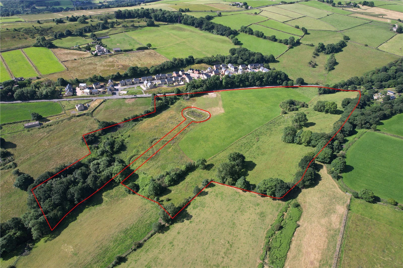
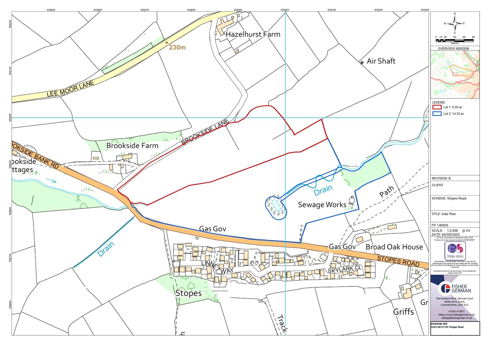
Enclosed in a ring fence, the land extends as a whole to about 23.59 acres (9.55 hectares) and is down to pasture.
Classified as Grade 4, the soil is of both the ‘Dale’ and ‘Rivington 1’ series, noted as suitable for permanent or short-term grassland and associated predominantly with stock rearing.
The land is subdivided into two lots:
Lot 2
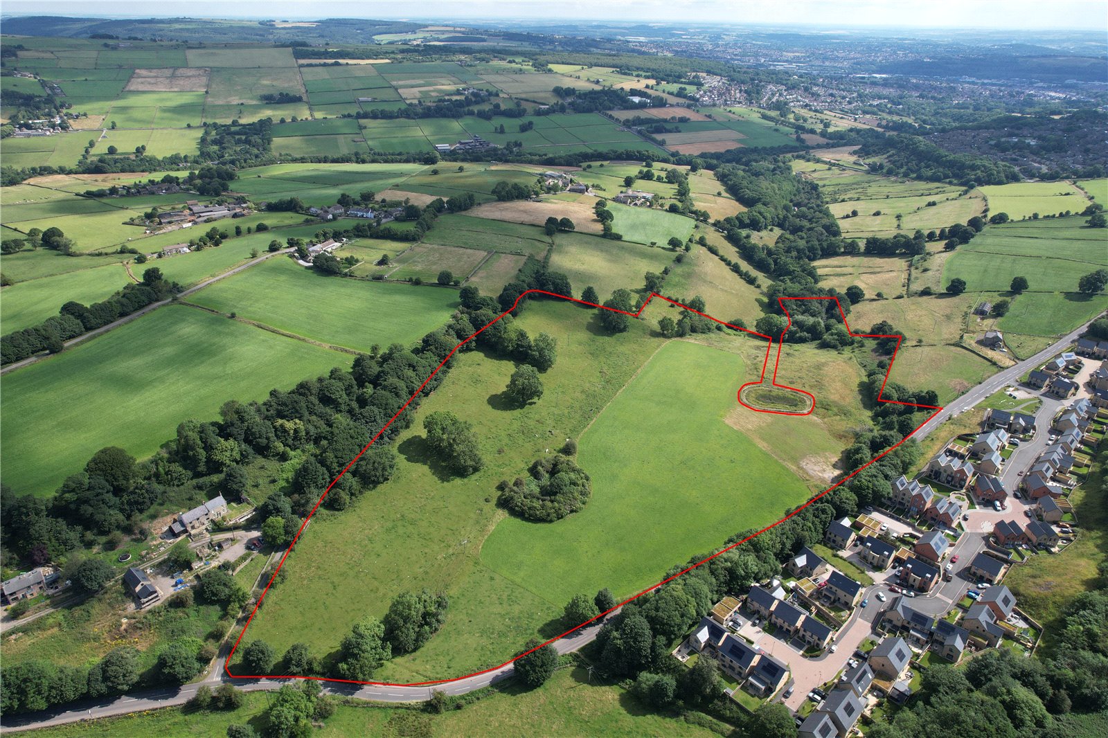
Lot 2 extends to 14.33 acres (5.80 hectares) and is flat for the most part, although gradually sloping away to the east down to Storrs Brook. There are two access gateways off Stopes Road. There is an area of compacted earth and stone that had once been a car park for the former Griff Works on the south side of Stopes Road. The land is outlined blue on the sale plan.
Method of Sale
The land is offered for sale as a whole or in two lots by Private Treaty.
Tenure & Tenancies
The land is offered for sale with vacant possession on completion.
Services
Prospective Purchaser(s) must satisfy themselves as to the availability of all services and any future possible connections.
Wayleaves, Easements & Rights of Way
Overhead electricity lines cross Lot 1.
A right of way is granted to Avant Homes (England) Limited to access the balancing pond. Further details available from the selling agent.
The land is sold subject to or with the benefit of all wayleaves, easements, quasi-easements, rights of way, covenants and restrictions whether defined in these particulars or not.
Sporting & Timber Rights
Sporting and timber rights in so far as they are owned are included within the sale.
Minerals Rights
Mineral rights in so far as they are owned are included within the sale.
Basic Payment Scheme
The land is registered with Rural Payments Agency however the sale does not include any entitlement. The incoming Purchaser(s) may be required to provide an indemnity any breaches of cross compliance for the 2023 scheme year.
There are no environmental schemes in place.
Obligation
Avant Homes (England) Limited is obligated to erect and maintain a fence around the balancing pond and channel. Further details available from the selling agent.
Overage
The Property is to be sold subject to an overage for 25 years whereby 25% of any uplift in value over the prevailing permitted existing use value following the grant of any planning permission for any future uses other than agricultural and equestrian will be payable to the Vendor or their successors. The payment will become due on the implementation or disposal following the grant of planning consent or following the exercise of any permitted development rights. The overage period will be extended to cover any unexpired period of any unimplemented planning consent during the initial overage period.
VAT
Should any part of the sale or property become chargeable for the purpose of VAT, then such tax will be payable by the Purchaser(s).
Local Authority
Sheffield City Council
Viewings
Unaccompanied viewing of the land to be conducted on foot during daylight hours only and when in possession of these particulars. We would request that you contact Fisher German prior viewing.
Directions
From Sheffield city centre, follow the inner ring-road until you reach University Square (J6) roundabout. At the roundabout, take the exit on to the A57 signposted Glossop and follow for 1.8 miles. As you approach the Sportsman pub, turn right on to Stephen Hill and continue to follow the road which changes to Back Lane and then Bole Hill Road, and after 0.6 miles, turn left on to Hagg Hill and at the end of the road, turn right on to Rivelin Valley Road. After 0.4 miles, turn left on to Hollins Lane then after 0.3 miles turn right on to B6076 and continue along this road for 1.8 miles whereby the land will be on the right.
Postcode - S6 6GE
What3Words:
Lot 2 - ///slang.switch.timing
Health & Safety
For your own personal safety, we ask that you to take great care and be as vigilant as possible when making an inspection.
Plans, Areas & Measurements
The plans, photographs and measurements within the sales particulars are provided for identification purposes only and do not form part of the sale contract and the purchaser(s) shall be deemed to have fully satisfied themselves as to the description of the property and neither the vendor nor the vendors agents will be responsible for defining the boundaries or the ownership thereof.
Guide price £150,000
- 14.33 Acres
Land for sale Stannington, Sheffield, S6
A useful sized block of grassland situated to the west of Stannington, on the edge of the Peak District National Park in the county of South Yorkshire.
- Lot 2 - 14.33 acres
- For sale by private treaty